Back Bay of Biloxi Fishing Spot
- County: Harrison
- Public Fishing: Yes
- Mean Depth: 7'
- Max Depth: 35'
- Elevation: 1'
- Shoreline: 10'
- Website: http://www.thefin.com/fishing-report/Biloxi-Bay-Back-Bay-of-Biloxi-2009-4-13
- Last Modified By: chief on 07/10/15 03:12 AM
- Ask about Back Bay of Biloxi in our Fishing Forums
Photos
Fish Species
Comments
-
Stick to the Fall and Spring for big trout. Reds and flounder are present almost year round. Lots of gaftop and hardheads during the Summer. Depending on salinity levels, I have seen spanish mackeral and shark as well. White trout, ground mullet, gar, it has it all at different times of the year.
-
Good winter fishing for Saltwater species and many public access points. Provides for a great day in the sun boating with the chance of some quality fishing.
Back Bay of Biloxi Baits and Tackle
Live Bait (Other) Check Prices
- Dead Shrimp, Squid
Saltwater Jig Check Prices
- 1/4oz chartreuse cocoho minnows
Shrimp Bait Check Prices
- Dead shrimp/Blue crab fished on bottom.
- Dead shrimp on bottom
Back Bay of Biloxi Description
Generally considered to be the portion between the Biloxi US Hwy 90 bridge and the Popps Ferry bridge between Ocean Springs and Gulfport. Fresh to Salty, but usually brackish. Can catch everything from bass and bluegill to Reds and trout with many surprises thrown in for good measure.
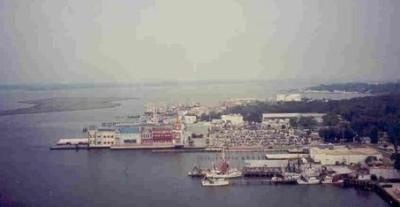
The Back Bay is a large bay that extends from the mouths of the Tchoutacabouffa and Biloxi Rivers and empties into the Gulf of Mexico. It is connected to the main part of Biloxi via bridges. It is shallow (except for a shipping channel for boats and tugs) with many "islands" of sea grass which is home to marsh birds, fish, crabs, shrimp, and nutria. Biloxi's main highway is U.S. Highway 90 (Beach Boulevard), which runs along the beach and by the casinos. It connects the city to Gulfport and points westward and to Ocean Springs and Pascagoula to the east. The Biloxi-Ocean Springs Bridge across Biloxi Bay was rebuilt following Hurricane Katrina, and was fully reopened in April 2008. Through the northern sections of the city, Interstate 10 passes through, connecting the city to New Orleans, Louisiana, Houston, Texas, Mobile, Alabama and Jacksonville, Florida. Interstate 110 splits off from I-10 at D'Iberville and heads south across the Back Bay of Biloxi to U.S. 90 near Beau Rivage, providing the city with an important hurricane evacuation route. Biloxi offers some of the finest sportsfishing along the entire northern coast of the Gulf of Mexico. Spotted seatrout, red drum, Spanish and king mackerel, flounder, snapper, grouper, sharks, and more are all available to anglers during the fishing season.